UP Meteorologists Study How Storms Evolve Near PH Coasts, Highlighting Urgent Preparedness Needs
Published: December 26, 2025
By: Eunice Jean C. Patron
An analysis of 45 years’ worth of Philippine tropical cyclone (TC) data reveals insights into how storms behave as they approach and make landfall in the country—considered as one of the world’s most cyclone-prone regions.
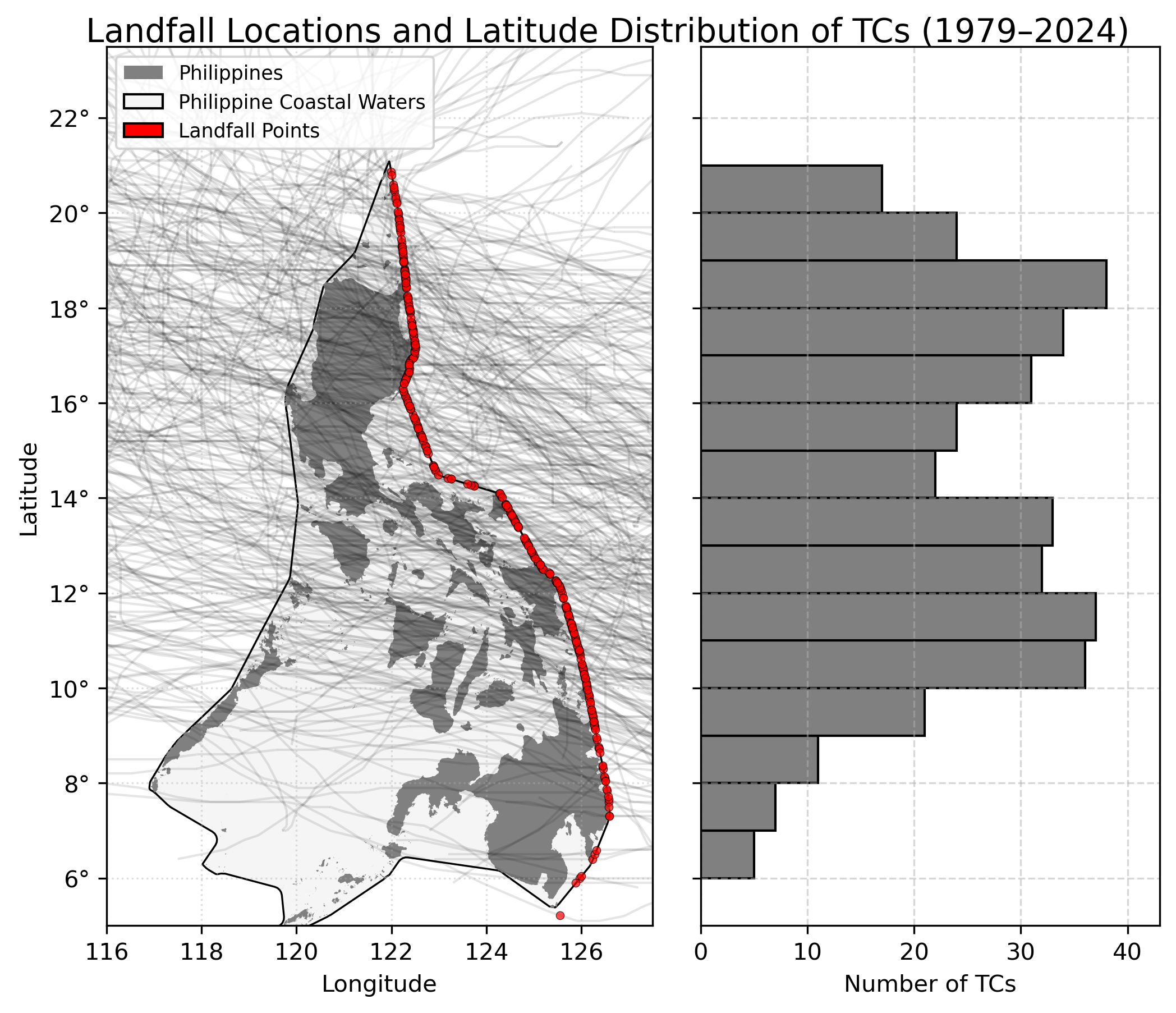
Drs. Bernard Alan Racoma and Gerry Bagtasa of the University of the Philippines – Diliman College of Science’s Institute of Environmental Science and Meteorology (UPD-CS IESM) examined 372 landfalling TCs from 1979 to 2024 and showed patterns that highlight operational challenges and the need for better preparedness.
“Storms that hit the northern part of the country tend to be stronger but slower moving. Southern storms tend to be faster and accelerate more rapidly,” Dr. Racoma explained in an interview. “This has implications on the kinds of hazards these storms may bring.”
Fast-moving and rapidly accelerating storms in the Visayas and Mindanao give communities limited time to prepare, whereas the stronger yet slower-moving storms affecting Luzon heighten the risk of prolonged flooding and landslides.
Although TCs often stay inside the Philippine Area of Responsibility (PAR) for several days, the meteorologists found that their direct presence along the Philippine coasts is brief—averaging only 21 hours before moving inland or away.
“In terms of geometry, medyo balingkinitan ang Pilipinas: mas pahaba ang bansa north-south, kumpara sa east-west. Since TCs usually move from east to west, they tend to cross this shorter path faster,” Dr. Racoma said, pointing out the contributing factors. “Another possible explanation is because of the loss of the fuel source—the warm ocean. TCs draw their energy from the sea, and they typically don’t like staying over land.”
The meteorologists emphasize that understanding both the timing and intensity evolution of the storms is key to reducing disaster risk. They recommend that communities treat all developing storms seriously, and to monitor when TCs enter or form within PAR. “Rapid intensification occurs very fast—typically within 24 hours. We don’t yet fully understand it; even weak storms can intensify quickly. We should avoid waiting for a storm to intensify before preparing. Half of TCs that form or enter the PAR make landfall, and usually rapid intensification occurs within this region,” Dr. Racoma noted.
“Characteristics and Near-Landfall Behavior of Tropical Cyclones Affecting the Philippines (1979–2024)” was published in Tropical Cyclone Research and Review, a journal focusing on tropical cyclone monitoring, forecasting, research, and their related impacts on disaster risk reduction. The study was supported by the UPD Office of the Vice Chancellor for Research and Development and the Department of Science and Technology – Philippine Council for Industry, Energy, and Emerging Technology Research and Development.
References:
Racoma, B. A., & Bagtasa, G. (2025). Characteristics and near-landfall behavior of tropical cyclones affecting the Philippines (1979–2024). Tropical Cyclone Research and Review. https://doi.org/10.1016/j.tcrr.2025.11.004
For interview requests and other concerns, please contact media@science.upd.edu.ph.